| |
CCCGeomática uses a portable demo system, as seen in the picture, to show to clients on site or in trade shows, how gison3dmap works.
A key component of this system is a portable hanging device, with a telescopic neck, that is used to hold a Panasonic XGA video projector, and project video vertically, from top to bottom.
A small server with the gison3dmap server side software and a laptop with the Calibrator and the ArcGIS and Multimedia client's software, are used to select data to be projected on the 3D Map located on top of the table.
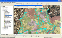
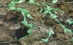
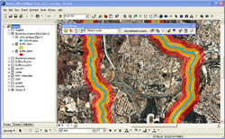
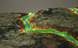
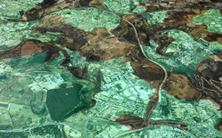
The following pictures, which you may see in detail by clicking on each one, show side by side, a ArcGIS client view showing GIS data and the corresponding gison3dmap projection, on top of a 80x50 cm 1:10.000 scale 3D map of the Taguspark (Oeiras, Portugal) area. |
|