| |
gison3dmap >> Examples >> Sintra 3D Landscape |
<< back |
|
| |
|
|
| |
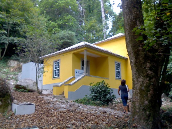
CCCGeomática concluded its 10th gison3dmap system installation on November 2010, for the "Parques de Sintra Monte da Lua, SA" (PSML).
Located at the "Casa do Pomba"l (left on the next image) close to the East entrance of the "Parque da Pena" (Pena park), the Sintra 3D Landscape purpose is to offer the Pena park and the Pena palace visitors, a global perspective of the Sintra mountain, its landsape and its monuments. Click here to obtain the Sintra 3D Landscape brochure.
|
|
| |
|
|
| |
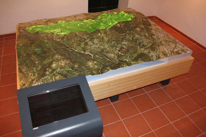
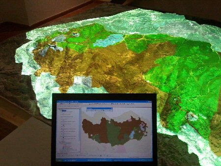
The system uses a 3d solid terrain model of the Sintra mountain, including all the areas under PSML management, in which the Sintra World Cultural Landsape area is included, that can be seen right on the previous image, projected green on the 3d model.
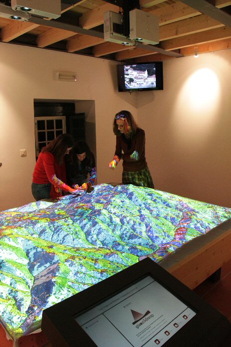
The scale is 1:3.000, and the model is made of two panels, with a total dimension of 2,12 x 1,8 meters. The vertical exageration is 1,2 times (vertical scale equal to 1:2.500) and the total relief is close to 21 cm.
At this scale, it was mandatory to represent the most emblematic monuments of the Sintra World Cultural Landsape, and 3d solid models at 1:2.500 scale, were produced for the "Palácio da Pena", "Castelo dos Mouros" and "Palácio de Monserrate". The first two are visible left on the next image.
|
|
| |
  |
|
| |
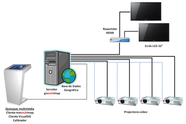
The Sintra 3D Landscape gison3dmap system, right on the previous image, uses a Windows 7 server with 6 graphic outputs, where resides the geographic data that is projected on the 3d map.
Four graphic outputs are connected to 4500 Ansi lumens Sanyo XGA PLC XU-105 projectors, and one is connected to two LCD screens, by means of a HDMI splitter. Projectors are controlled by the gison3dmap server using infrared leds.
Visitors interact with the system using a multimedia application which executes on a touch screen quiosk, and integrates hierarquical organized contents, both in Portuguese and English (left on the next image).
While navigating in this application interface, and also as a response to the touch of projection buttons available on the interface bottom, geographic related contents will be projected on top of the 3d map, syncronized with the presentation of both videos and images on the two LCD screens located at the two room corners behind the 3d map.
|
|
| |
  |
|
| |
Ad-hoc interaction with the gison3dmap system is made using the two GIS clients, VisualSIG and ArcGIS (right on the previous image), to dynamically select, render and project geographic data on top of the 3d map. VisualSIG is installed on the multimedia quiosk, while the ArcGIS client is used from wireless connected laptops.
GIS clients are also needed both to prepare the geograpich data to be used by the system, and to generate and capture the projection commands that are used by the multimedia application.
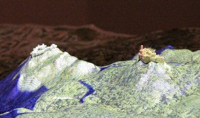
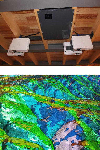
Left on the next image, it is shown a aspect map projected on the 3d map from the multimedia application running on the multimedia quiosk, visible in first plane. This image shows also the location of the video projectors on the ceiling, above the 3d map, projecting light vertically, from top to bottom.
In this installation, the access to the projectors for maintenance, is made by displacing the table, which includes and hydraulic elevation system with weels. 4 guides on the floor are used to correctly reposition the table and avoid the need to recalibrate the system.
|
|
| |
|
|
| |
Right on the previous image, a detail of the projected aspect map is shown, which allows to recognize high quality of the projection achieved on this gison3dmap system, and which results not only from the good resolution of the four projected images, but also as a consequence of the high quality of the gison3dmap system calibration process.
|
|
| |
|
|
| |
^ top |
|
|