| |
gison3dmap >> Examples >> The “Lamas de Mouro” gateway to Peneda-Gerês National Park gison3dmap system |
<< back |
|
| |
|
|
| |
Melgaço County, the up most north in Portugal, has a gison3dmap system installed at the "Lamas de Mouro" gateway to the Peneda-Gerês National Park, to present the County and part of the National Park to their visitors. |
|
| |
 |
|
| |
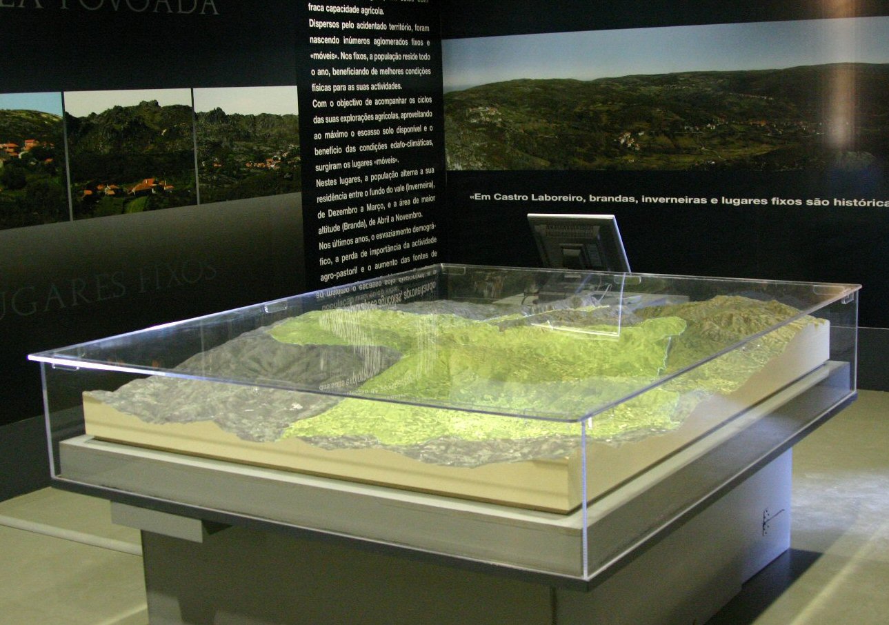
The figure shows the Melgaço County 3D Map, oriented NNW-SSE, with the County area projected (light green).
The 3D map is 1.46 meter wide and 1.73 meter long, and has a 1:15.000 horizontal scale and a 1:10.000 vertical scale.
Different datasets from Portugal and Spain were required to produce this 3D map. Data from Portugal was provided by Geoglobal and data from Spain was an offer of Xunta de Galicia. |
|
| |
|
|
| |
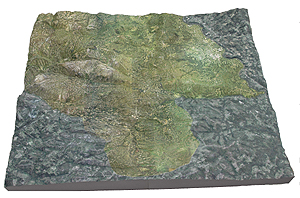 Two digital Terrain Models and two color ortho photography products from both Portugal and Spain, were combined by CCCGeomática to produce the two 15 meter Digital Terrain Models and corresponding georeferenced map images, that were used by Solid Terrain Model to produce the two panels this 3D Map is made of. Two digital Terrain Models and two color ortho photography products from both Portugal and Spain, were combined by CCCGeomática to produce the two 15 meter Digital Terrain Models and corresponding georeferenced map images, that were used by Solid Terrain Model to produce the two panels this 3D Map is made of.
Because the map (shown in the picture facing South) was to be used with a gison3dmap system, it was kept as simple as possible, so it only included the ortophotography, the Portugal-Spain border and a few river and populated place's names. |
|
| |
|
|
| |
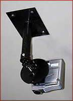
The “Lamas de Mouro” gison3dmap system includes a ArcGIS client, a small server with a dual head graphic board, and two XGA video projectors, fixed to the room ceiling by means of specially designed mounting devices.
Several GIS datasets, including administrative boundaries, populated places, and the County 1:10000 scale GIS database, were initially prepared to use with the gison3dmap system. |
|
| |
|
|
| |
^ top |
|
|