gison3dmap
homepage
recommend site
add site to favorits
Versão Portuguesa
gison3Dmap ... software files to download ... our contacts ...
 
 
  gison3dmap >>  Exemplos  >> The Centro de Interpretação da Serra da Estrela gison3dmap system << back  


Among the many reasons to visit the "Centro de Interpretação da Serra da Estrela" (CISE), located in Seia, is a 1:35000 scale solid 3D map of the "Parque Natural da Serra da Estrela" (PNSE) and the Seia county, on which visitors can see projected the PNSE geographic information they select navigating the menus presented on a LCD touch screen.


The image on the left shows a general view of the CISE thematic exhibition, where one can see the PNSE 3D map and a few thematic panels. The image on the right shows a closer view of the PNSE 3D map and the LCD touch screen that visitors use to interact with the system, where a multimedia menu driven application presents thematic screens with buttons that once pressed, originate the projection of geographic information on top of the 3D map.


At the core of this system is the gison3dmap software that controls two video projectors located in the room false ceiling. The multimedia application (mmon3dmap) was designed with the purpose to add a simple and efficient way for users to interact with this system, allowing CISE technicians to easily modify the application thematic contents and the corresponding information to be projected on top of the 3D map.

This possibility, allied to the fact that the system uses a geographic database, which can be edited at any time, provides complete freedom to define new contents for visitors to interact with and see projected on the 3D map.


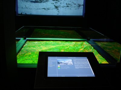
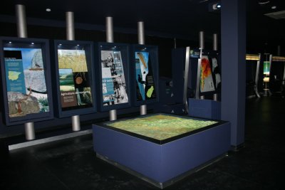
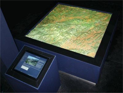
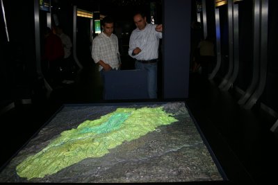
On the left image, one can see a current view of the Serra da Estrela 3D Map, wich is now surrounded with a glass wall, and where the Corine LandCover 2000 land use map is being projected.

In November 2009, CISE gison3dmap system was upgraded to include a third video projector to present thematic videos.

Those videos are presented on the screen beyond the 3D model, and trigger the synchronized projection of related geographic information on the 3D model.

Included in this upgrade was a trainning on the new software capabilities, including the creation of multimedia contents and the preparation of geographic themes and gison3dmap command sequences using the ArcGIS client.


The video than can be seen clicking on the next image, is the result of the work made during this trainning, and it shows images of diferent habitats synchronized with the projection on the 3D model of each corresponding geographic distribution.


  ^ top  
 
Copyright © 2006 CCCGeomática . Desenvolvido por Helcadesign