VisuLands is a international project that had the participation of researchers from the "Escola Superior Agrária de Coimbra" (ESAC) Forest Department, and had the following main goals:
- develop visualization tools that allow the public envolvement in the evaluation of landscape changes, and
- contribute to facilitate and promote a larger and better public participation in planning and in the definition of landscape related policies.
You can know more about this project at www.esac.pt/visulands/.
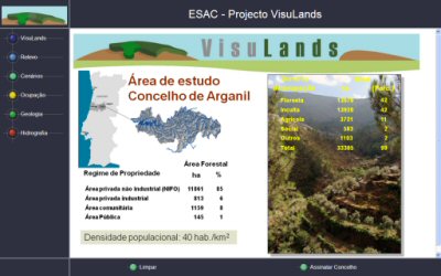 In Portugal, the case study area was the Arganil County, with a special focus on the "Área de Paisagem Protegida da Serra do Açor" ("Açor" mountain protected landscape area), for wich a projective and prospective analysis of county land use was developed considering a 100 years time frame. In Portugal, the case study area was the Arganil County, with a special focus on the "Área de Paisagem Protegida da Serra do Açor" ("Açor" mountain protected landscape area), for wich a projective and prospective analysis of county land use was developed considering a 100 years time frame.
ESAC selected the gison3dmap system as the presentation tool for the study results, and used it together with a 1:25000 scale map of the Arganil County, in wich the 1:25000 military cartography was printed.
The image on the left shows the project initial presentation screen, using a multimedia application (mmon3dmap) that issues projection requests to the gison3dmap system.
|


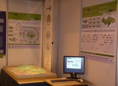 Following the project conclusion, this system was presented to the general public at the "3ª Jornadas de Tecnologia e Inovação" that took place in November 2008, at FIL Expo.
 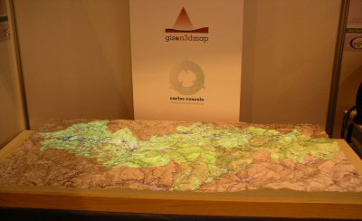 The image on the left shows in greater detail the Arganil County 3D map, in wich one of the land use evolution scenario is beeing projected.