The Territory Interpretation Center (TIC) of the "Revelim de Santo António", located in Castro Marim and inaugurated on August 15, 2009, is a "seduction center" where their visitors are invited to a journey around the county, aimed to discover the county natural and historical heritage, its people and their skills.
The "Revelim de Santo António" its a place of rare beauty, and the Interpretation Center a nice building designed by Architect José Alegria, that works as a scenic viewpoint towards the Castro Marim castle, the São Francisco fortress, the salt fileds and the Castro Marim marsh.
This interpretation centre was build as part of a global plan for the managment and valuation of the Castro Marim building heritage, develloped by Terra Culta.
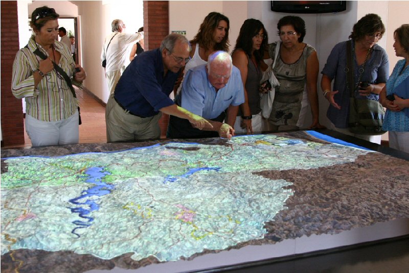
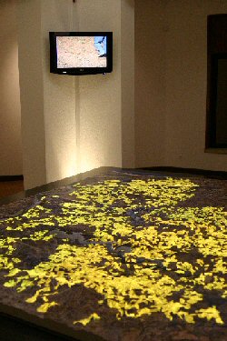
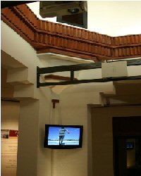
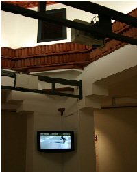
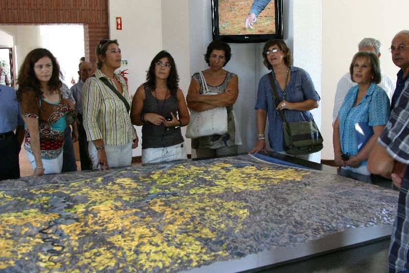
The 1:10000 scale 2 x 2.56 meter Castro Marim county terrain model, is the main piece of the Interpretation Center, and the invitation to depart on the exploitation journey around the Castro Marim territory, is made by means of a 20 minute video about the county territory history, its occupation, natural and building heritages and people, visible on 4 LCD sreens located on each model corner.
During this video presentation, with surround sound in Portuguese, but that visitors can listen in English, Spanish or French using audioguide devices, the model gets iluminated to show related geographic information. You can see a video ilustrating this at the bottom of the page.
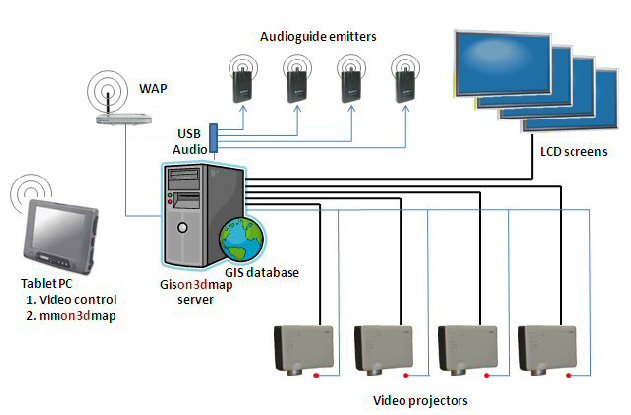
The technological infrastructure that makes this multimedia presentation possible, in which a video is seen simultaneously with the synchronized projection of related geographic information, is the gison3dmap system installed in this Interpretation Center, that is made of the components shown in the next figure.
The core of this system is the server that runs the gison3dmap software, where also resides a geographical database of the Castro Marim county. This server has 6 graphic outputs, where 4 VGA outputs are connected to 4 video projectors, and a HDMI output is connected to a video signal splitter that serves 4 wall mounted LCD screens.
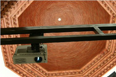
Each video projector deals with the projection on a specific area of the model, and is placed in a fixed position in relation to the model, mounted on a support with a 3 axis adjustment, hanging from two metalic beams located above the model, as seen in the next images.
The system is controled by a tablet Pc wireless connected to the server, where the mmon3dmap multimedia applicattion runs. This application allows to control the video execution and also to project selected geographical information on top of the terrain model while navigating on a hierarquical structure of menus and thematic screens.
The system uses audioguide devices to make it possibe to listen to the video in 4 diferent languages. The gison3dmap software channels each of the 4 diferent audio streams to one of the 4 USD audio devices according to the system parametrization, being each USB audio device connect to a specific audioguide emitter. Visitors can listen to the video in the language of their choice by selecting the appropriate channel in each provided audioguide receiver.
Start and stop the system is a simple and automated task available at the touch of a button, in which the projectors are switched on and off by the server using commands sent by means of leds placed close to each projector infrared sensor.
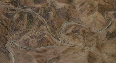
The solid terrain model was produced using a 10 meter resolution digital terrain model (DTM) and year 2007 IGP (Instituto Geográfico Português) digital ortophotography.
The ortophotography was subject to radiometric correction, editing and completion, and used to create the map that was printed on the model, which includes the Castro Marim county limits and a few place names.
The DTM used to create the model was the result of a combination of DTMs acquired both to IGEoE (Instituto Geográfico do Exército) and Intermap, and was subsequently edited to represent a few bridges, viaducts and overpasses as surfaces, instead of letting them follow the terrain, and forcing them to be shown on the model close to as they exist in the reality.
The system is prepared to be used for guided tours conducted by TIC technicians, using the mmon3dmap application running on the tablet Pc and the thematic contents organized within it.
Meanwhile it can also be used by county planners to present and discuss development, protection and contingency plans, using the gison3dmap clients availlable for the ArcGIS and VisualSIG GIS software.
VisualSIG is a "freeware" GIS and its gison3dmap plugin was develloped with a purpose; to allow the system to be used without software licensing restrictions by external entities, and specially by county schools.
The main goal is that students of local schools will be able to see projected on top of the county solid terrain model, the geography contents develloped as part of their school work.